Needed – A conservation saviour for Tanycastell land

by The Curious Scribbler

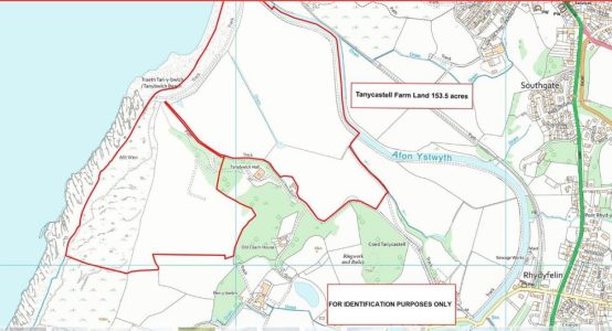
Barely had I returned from the walk around Pendinas when the news emerged of the imminent sale of the magnificent meadow and marshland which abuts Tanybwlch beach.  For long this land had belonged to farmer Lewis Jones of Ynyshir and Tanycastell farms,  – a man with an unenviable reputation for livestock neglect – and limited enthusiasm for SSSIs.  Following his death a couple of years ago the most coastal part of Tanycastell farm has now been put on the market with estate agents Aled Ellis.

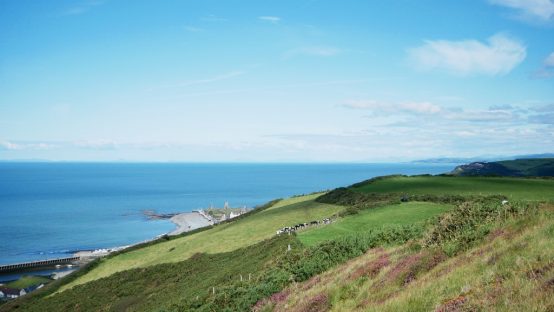
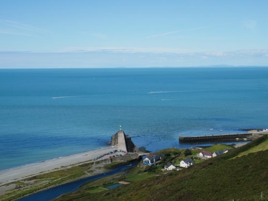
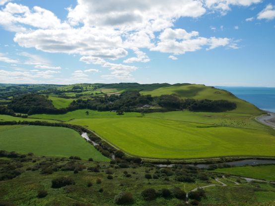
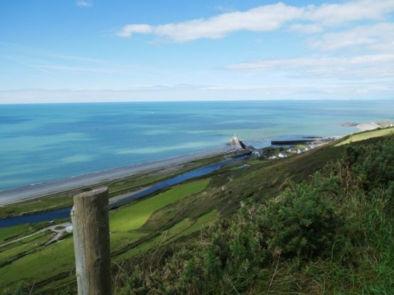
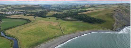
The area for sale is the stony barrier spit and three coastal fields south of the river Ystwyth and the steeply sloping meadow which clothes Alltwen cliff.  According to the particulars the 153 acres has a guide price of £1.4 million,  an average of £9150 an acre.   This seems a substantial sum.  Seventy seven acres is described as level pasture but the particulars omit to mention that part of it floods regularly and it is reverting below Tanybwlch mansion to salt marsh.  With rising sea levels it was already  resolved twenty years ago that the Tanyblwch flats cannot be protected from the sea.  A further  63 acres of Alltwen is described as sheepwalk.   This  perhaps overstates the case, for the land ownership extends to high tide mark so almost 1/3 of the Alltwen land area is cliff and tumbled former quarry inhospitable even to a mountain goat!

I worry deeply that this high price is not unconnected with the final words in the particulars:    The land will also be of interest to investors, statutory bodies and conservationists in additional to those who wish to develop a commercial enterprise (subject to planning) on the Southern fringes of Aberystwyth.

By a miracle Tanybwlch land has escaped a number of commercial enterprises. The previous owner was Col. Lewis Pugh who bought it in hope of installing Aberystwyth airport there, and on failing to secure the necessary investment sold it in the 1960s to Lewis Jones.    Some 35 years ago  I was one of the objectors who fought off the proposal to install a sewage maceration plant which would mince Aberystwyth’s sewage and discharge it, still rich in microbes, a little further out to sea. ( Thankfully a state of the art  treatment plant was instead built on the Rheidol Industrial estate, and our sea is the better for it).

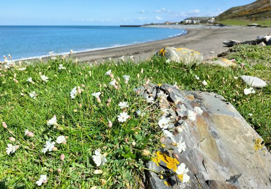
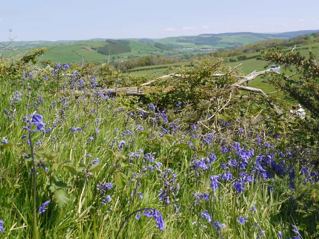
But what commercial horrors might now threaten this beautiful piece of land?  We must hope that our planning authority would be equal to the task of fending off development.   This is a piece of land which richly deserves a conservationist owner.  The Alltwen and Traeth Tanybwlch SSSI  (Site of Special Scientific Interest) represents the rare and specialist coastal flora of the shingle beach.  Sea holly, sea sandwort, restharrow and horned poppy are among the most conspicuous of an elite flora and Ray’s knotgrass one of the rarest. The sheepwalk above is one of the finest locations for waxcaps and the remarkable Devil’s Fingers  fungi in the county.  Wheatear and rock pipit nest on the stony shore, and choughs, peregrines and  ravens frequent the cliffs.

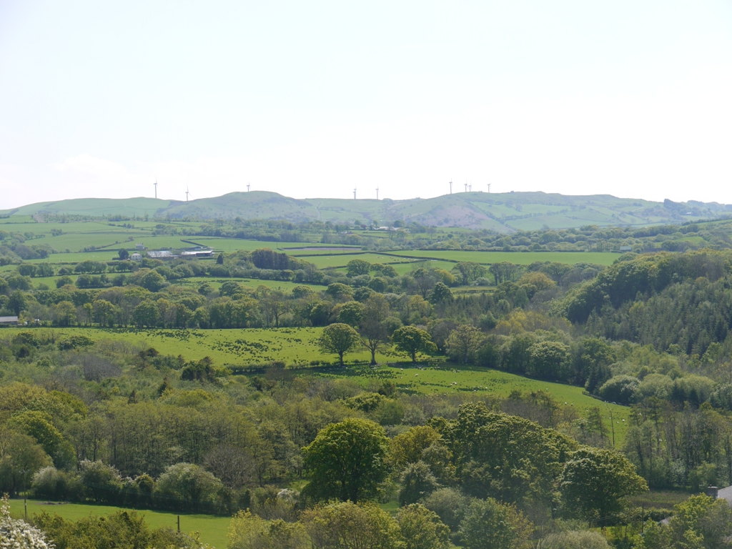
As climate changes it is becoming even more diverse.  With rising seas and fiercer storms the south west corner at the foot of Alltwen now forms a shallow lagoon for long periods of the winter, and the pool is visited by teal, widgeon, mallard, redshank, curlew, lapwing, heron, little egret and migrating geese.  The vegetation is already changing to saltmarsh, and if the land drains were blocked, a marsh as important as the Dyfi will soon develop.  One day the shingle spit may be entirely breached and the river Ystwyth may resume an earlier course towards the sea.

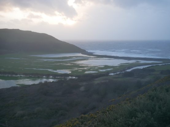
Flooding of Tanybwlch flats after Storm Dennis in 2020

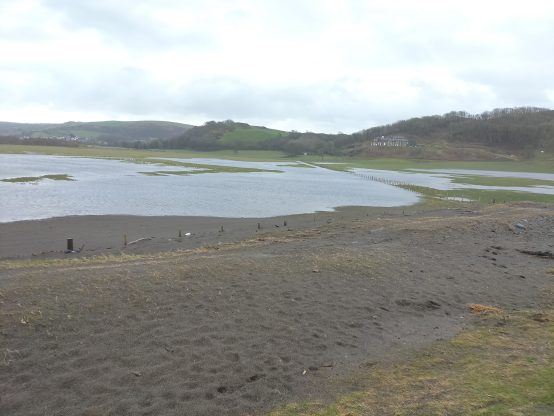
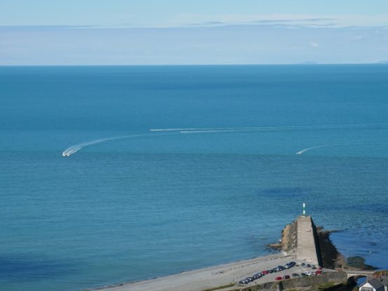
The sea deposited loads of sand over the shingle bar and into the fields February 2022

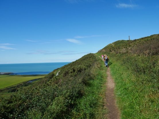
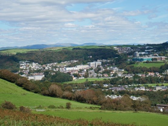
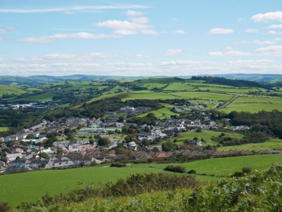
All this nature and beauty on the very doorstep of Aberystwyth is a magnificent asset and with a more specific designation could bring yet more visitors to the town.  Lying between Pendinas, the finest hillfort in the county and the wooded slopes of the original Aberystwyth Castle, and skirted by the Welsh Coastal Path,  these fields are an incomparably important part of the scenery and must be protected.    A conservation saviour is urgently required.

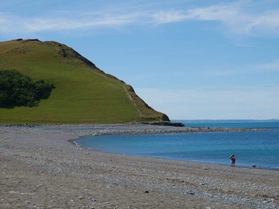
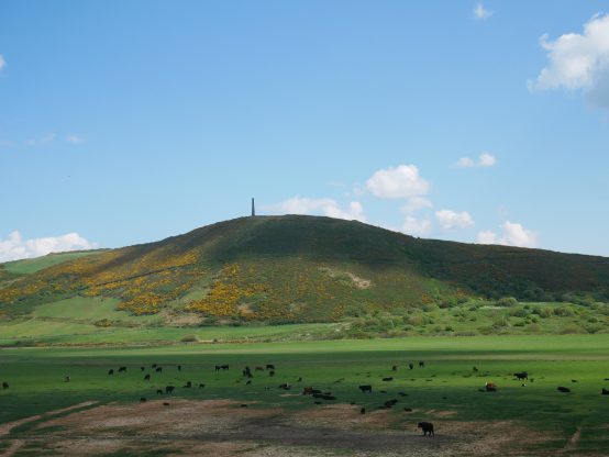
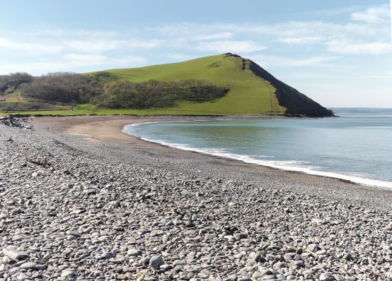
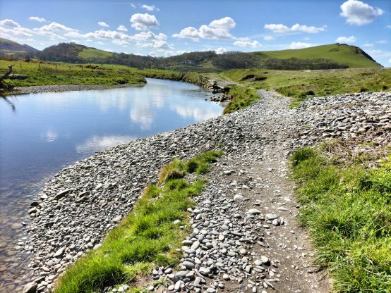
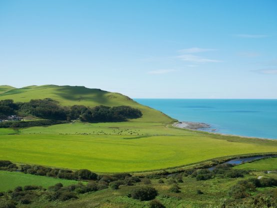
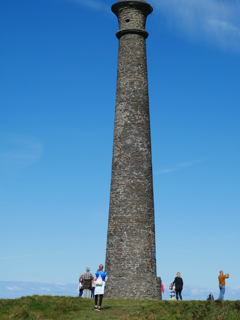
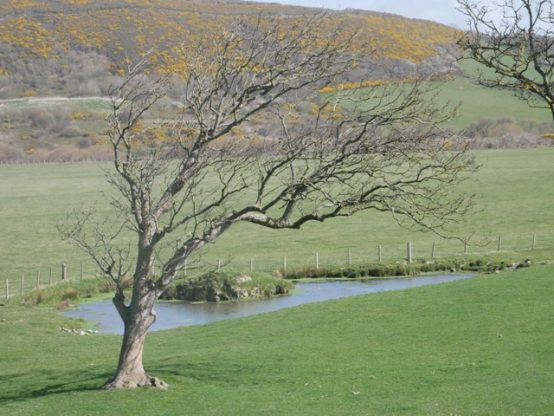
Alltwen cliff   May 2020.  In autumn and winter the slope is rich with fungi

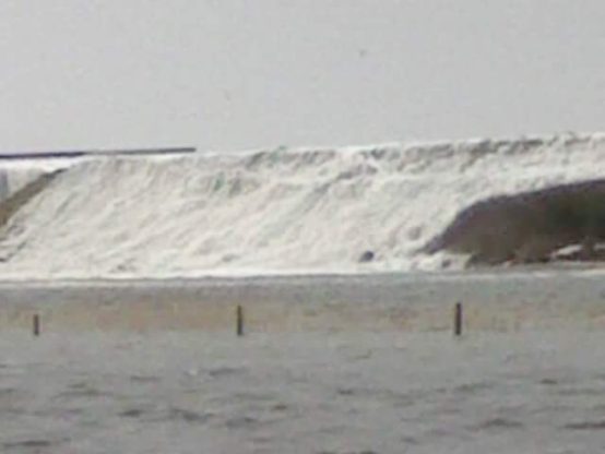
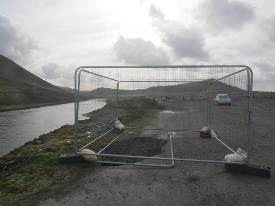
Scenes like this one during Storm Dennis  in February 2020 will much reduce its viability as farmland

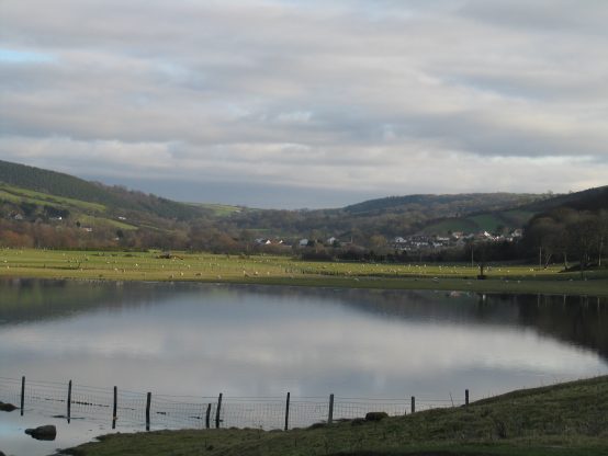
The permanent lagoon which tries to form each winter  would  further enhance the area. 

Share Button

A walk round Pendinas

by The Curious Scribbler

I was one of thirty people who joined Beca Davies, Project Community Outreach Officer for the Pendinas Hillfort Archaeology Project, on a relaxed evening stroll around the lower slopes of Pendinas yesterday evening.

We met at the gate in Parc Dinas, traversed the middle path across the flank of the hill and returned on the lower path past the horse field and across the former rubbish dump.  Stopping at intervals along the route Beca  and Richard Suggett contributed their knowledge and further insights emerged from the group.

The Wellington monument, which stands within the iron age hill fort, was the brainchild of William Eardley Richardes of Bryneithin.  Richard Suggett reminded us that public subscription had been limited and  as a result the proposed equestrian statue of the Duke of Wellington was never placed on top of the gun barrel column.  This is perhaps not surprising in view of the fact that it was not constructed until 1856, forty years after the  battle of Waterloo!  William E Richardes had, as a young officer, served in the army of occupation after the victory, but this was a monument stimulated by the death of the Duke of Wellington aged 83 in 1852.  Possibly local interest in him had considerably waned by this time. More significantly the monument was sited such as to form a splendid eyecatcher when viewed from William’s home at Bryneithin!   Today it would be considered very poor taste to erect a modern monument on top of such an important ancient site!

We looked out, across the Tanybwlch flats and its palimpsest of the trotting races etched on the grass, towards the tree-fringed hill top which is the site of the original Aberystwyth castle.  This was Gilbert de Clare’s ring and bailey castle with a wooden stockade, built in about 1110 AD and repeatedly fought over by the Welsh and the Norman invaders.  Llywelyn Fawr took it back in 1221 and later built a stronger fortification on the stony headland to the north.   In 1277 after more than 150 years of skirmishing Edward I massive stone castle was built there, north of the mouth of the Rheidol but the name was never changed.  Perhaps to the King and his strategists In London the geographic niceties of Aberrheidol Castle seemed unimportant.  Prof Fred Long brought us a similar story from the 1940s.  Two war time radar stations were to be built in Ceredigion, one at Llanrhystud and one at Tanybwlch.  The Tanybwlch site was soon deemed unsuitable, probably because of the risk of flooding.  So the radar station was installed on Constitution Hill instead,  but was always known in the army documentation as Tanybwlch!

Our outward path then led us past the foundations of a two storey farmhouse which stood beside a natural spring adjoining the path.  Beca showed us a black and white photograph  where the farm was occupied and the farmer stands surrounded by chickens outside his front door.  A barn stood at right angles to the house.  The image is thought to have been made around 1930.

I’ve since looked out a much earlier picture, in the collections of the National Library of Wales. Drawing Volume  56  contains  twenty two North Ceredigion scenes  described as the work of  ‘Welsh Primitive’  c.1830-1853 .  Pendinas seems a little taller lumpier than it looks today and the foreground shows fishermen apparently below a weir on the river.  But the divisions of the fields on the slope, the farmhouse, and the track we walked along seem accurately represented.  The monument is depicted on the top, so the picture cannot be before 1856.

The primitive painter’s view of Pendinas ( NLW Vol 56)

The fishermen’s costumes may give further indication of the date.

Another view entitled  Pendinas and the River Ystwyth shows the farm on the hill and  a rider fording the river near a watermill below the south slopes.  Here too the monument is shown.

Pendinas and the river Ystwyth ( NLW Vol 56)

We learnt about the common lizards and slow worms which are numerous on the Pendinas.  Chloe Griffith’s Nature of our Village project has led to a much wider understanding of the importance of the site.  The spring is home to palmate newts.  This water source was presumably also important to the iron age inhabitants, for without it they would have had  to carry water all the way up from the river Ystwyth at sea level.

A third picture in the volume is captioned  Tanycastell Bridge Perhaps it was painted a few years earlier, for the monument is not to be seen.

The bridge at Tanycastell ( NLW Vol 56)

One of the Welsh cobs at Spencer’s sheds entered into the spirit of the evening by trying to nibble Beca’s backpack. Frustrated in this endeavour it rhythmically and noisily kicked a big galvanised box until we all moved on.

The return journey was on a less historic path which was created after the old town rubbish dump had been covered with soil and re-vegetated in the 1990s.  Willow scrub, gorse, brambles and nettles form an impenetrable undergrowth.  Here the path cuts down through the reclaimed ground and fragments of bottles and polythene appear at the surface where they have been excavated by the rabbits, foxes and badgers whose paths run through the brambles and bushes.

In the 1980s I remember when the wire fences on the Tanybwlch flats were festooned with tattered polythene bags whipped away from the dump by the wind.   We should be proud that Pendinas now looks almost as pristine as it did in these old paintings.

Pendinas in May 2020. The middle path traces the historic route across the flank of Pendinas


Share Button

Tanybwlch Beach in the next decade?

by The Curious Scribbler,

There are few places more beautiful than Tanybwlch beach on a fine spring day like today. It is pristine, almost empty, wild and picturesque. It also has an ancient resonance, for more than a thousand years (about 800BC to 1200 AD) the people of the  Pendinas hillfort will have foraged along this shore.

Alltwen at the south of Tanybwlch Beach


At the south end below Alltwen the wheatears are back, preparing to nest in the holes amongst the tumbled stones which form the bank.  Small parties of swallows hawk northwards following the shore line, still on their way to their summer homes.  Parties of linnets pause chattering on the wire fence and the indefatigable chiffchaffs shout ceaselessly in the wood beyond.    The thrift and sea campion are in bloom.

Sea Campion

This is  a place dear to the hearts of many local people, beloved of dog walkers and naturalists alike.  It has taken the brunt of ferocious storms and rising sea level which have, in the last few years caused  drastic changes in the shape of the strand.  The Tanycastell field below Alltwen  has long tended to become a shallow lake during winter time but is now well on the way to becoming salt marsh.  Here the waves don’t so much wash over as percolate through the pebble bank and the species composition of  grasses and sedges in the field is changing to a salt-tolerant flora.

Along the sandy middle section of the strand the  shore is eaten back every year now, and much of the stabilizing vegetation on the sloping sand bank facing the sea has been washed away.  The most recent rock sea defences, big stones placed to break the waves, now lie irrelevant yards down the beach.

The concrete barrage half way along is no longer passable to vehicles.  Near here the sea floods over with  great force carrying big cobbles off the beach and depositing them in the river Ystwyth beyond.  The riverside path is disappearing in several places.

Pebbles spill over into the Ystwyth river

But the greatest threat to public enjoyment is the erosion in the car park.  Three years ago during Storm Ciara a small hole opened up allowing storm water to drain through rather than over the hard standing behind the tall buttressing wall which extends from the bridge.  Sadly it was not blocked with concrete right away.

In February 2020 Storm Ciara excavated the first sink hole.

Some security fencing was erected around it and nothing was done. During lockdown and beyond, it grew and grew, and the original fencing collapsed into the hole.  Wider and wider areas have been fenced off as the tall wall continues to collapse.   And the potholes where cars enter the car park have now deepened so far that soon it will be impassable to all but all-terrain vehicles.

The retaining wall supporting the car park undergoing collapse

A huge void has been excavated by successive storms

If the car park is lost the nature reserve will benefit.  With lesser footfall we may get more breeding birds, like the common sandpipers I saw today which seemed to be hoping to establish a territory close to  the bridge, and eager to lead me away.  Otters, kingfishers and goosanders already frequent this part of the river.   As long as the bridge remains, walkers will be able to follow the coastal path but without a car park public usage will change.

A new hole has recently appeared and is currently garnered with a red plastic fence..  The water which has rushed down this sinkhole has already excavated the mortar from another stretch of the riverside wall.  The rate of collapse shows no sign of slowing down. Will the future of Tanybwlch Nature Reserve be determined purposely or by neglect?

Who cares?  and indeed which agencies are responsible for this wall?

The new hole. Tanybwlch

Masonry has  already been eroded by water gushing through the new hole


Share Button

A perfect day for Pendinas

By The Curious Scribbler

It is hard to remember last week’s grey shrieking storm.  Yesterday I walked up Pendinas in balmy sunshine, and a gentle breeze.  The sea looked as blue as the Mediterranean and the recently turbulent ocean is now calm and translucent – one can see the dark shadows of clouds upon the water, but also the shaded blotches of underwater outcrops of rock under the sea.  Looking over towards Alltwen, the black cattle were all grazing on the flat land.  Some mornings they are spread right up the hillside above the woods which enfold Tanybwlch mansion.  There is a grandeur in seeing the cattle spread out  like wild things in this huge landscape, not penned in a modest field of monocultural grass.  The flats are no longer the scene of the trotting races, but viewed from Pendinas one can still see the ghost of the grass track, subtly darker, perhaps better fertilized, than the rest of the meadow.

Alltwen and the Tanybwlch flats viewed from Pendinas

The climb is a prolonged one, even from the ‘easy’ access at the top of Cae Job in Penparcau.  Families toiled up the path to the iron age hillfort, topped with Victorian arrogance by the chimney-like monument to Wellington’s victory at Waterloo.

The path up from Cae Job

At least that is what it ostensible is.  Personally I think of it more as a monument to a local gentleman, William Eardley Richardes of Bryneithin Hall who built it in 1856 and invited subscriptions from the town.  It is no coincidence how grandly it adorns the landscape as viewed from the windows of his mansion to the south.  The victory at Waterloo was in 1815, and I would have thought that by 1856 national fervour for a monument would have somewhat abated.  Richardes himself had been in the army of occupation after Waterloo, and was moved to re-name the five fields around his house  General, Governor, Captain, Lieutenant, and Major!  They appear thus on the tithe survey of 1848.

The wellington memorial on Pendinas

There were quite a few people at the top, typically facing in all different directions!  The 360 degree panorama laid out before us has no weak point.  Take your pick for views of the harbour and the sea and the distant Lleyn Peninsula, Penglais Hill punctuated by the Hospital, the National Library and University of Aberystwyth, or Penparcau spread out around its green-roofed 20th century primary school.

I first sat on the seaward side, where the bracken and gorse given way to heather and coarse grass. A wren fidgeted around a dead tree stump below me, and the honey bees came in waves, sometimes there were none, then quite suddenly thirty or more were working their way through the flowers beside me,  then disappearing back to the hive.  This is a great spot for looking down on flying birds:  red kite, herring gulls, soaring the thermals, crows  sculling steadily across the fields.  Four speed boats came south into my view leaving white trails of wake.  When they gingerly slowed to creep into Aberystwyth harbour at low tide I could see underwater the bar which partly occludes the harbour mouth.

Aberystwyth Castle just visible from Pendinas

Speedboats approach Aberystwyth Harbour

It may be a Bank Holiday during a pandemic but there is space and beauty for all to enjoy.  Looking down, one could see around twenty cars parked at Tanybwlch beach now that the concrete barriers have been cleared away.  There has always been more than enough space for social distancing on that beach, and I am glad to see these unnecessary restrictions have been removed.

Penglais Hill, Aberystwyth, viewed from Pendinas

Penparcau, viewed from Pendinas

The view south from Pendinas

The Ystwyth enters the harbour at Penyranchor

Share Button

Tanybwlch – A Historic Video

by The Curious Scribbler

Day 67 of lockdown – the days have become a bit of a blur.  Like a soothing nature programme, the past two months have been generally beautiful, with startlingly clear skies, lovely wildflowers, continuous birdsong.  Too continuous even, I sometimes wish that the monotonous chiffchaffs would give it a rest.

My walks start from my front door, and lead me to Tanybwlch beach, Pendinas, Penparcau and Llanfarian along the footpaths and cycle paths.  I am so fortunate to have such an amazing landscape within easy reach.    Today I found a newly posted video on You Tube  named Aberystwyth in the SKY Tan Y Bwlch which gave me great delight.  Here  is a tranquil 4 minutes of a birds-eye view of my entire domain, shot during lockdown on one of the many still days when the sea barely sucks at the shore, the sun blazes down, and people, so few and far between, are visible here and there.  There are no cars in the Tanybwlch car park (a consequence of the concrete roadblock erected in late March), no contrails in the sky.  We may look back with nostalgia on this creepily empty scene when normal life is resumed.

I am pleased that the photographer has briefly included a child and a dog, (presumably his or her own) enjoying the shore.  Children have been out and about far too little during lockdown.   Joggers and cyclists have made the most of their freedoms, but to spy a child has been a rare sight on my walks.  Hopefully today’s announcement will empower more families to take their children out on our beaches.

At the very end of the film is the briefest glimpse of a huge new graffito on the concrete barrage where the Ystwyth turns northwards.  The brutalist blue capitals contrast with the human depicted on the left, a figure more typical of the ethos of the beach.

A screen grab from the video

It would be very visible from the sea: were anyone out there to view it.

Share Button

Life on Lockdown

by The Curious Scribbler

My dog and I have enjoyed some splendid walks in the last two weeks, happily all within my authorized orbit, accessible from my own front door.

The spring has been heartbreakingly beautiful and every day brings new delights.  A fortnight ago, the first chiff chaff appeared at Tanybwlch and within days the landscape became alive with them, belting out their monotonous song from tree tops and gorse bushes everywhere I walk.  The wheatears are back in the stones below Alltwen, and stonechats and dunnocks everywhere in the scrub on the flanks of Pendinas.  Woodpeckers drum in the alder trees by the cycle path and on several days there were no less than 35 choughs probing the sloping meadow on the foot on Pendidnas.  I’ve seen kestrel, buzzard and kite overhead and a heron stalking the incipient salt marsh behind Tanybwlch beach. Today I also noticed that two Canada geese have taken up residence in the small pond below Tanybwlch mansion, and look as if they are planning on goslings.  This pond has an island which will protect them from foxes.  It is a historic feature in the landscape, formerly a public watering point on Tanybwlch flats, immortalized in old maps and a watercolour from the early 19th century.

The watering hole below Tanybwlch mansion, now home to a pair of Canada Geese

The wildflowers are equally delightful, carpets of wood anemones in shady patches on the drive, celandines in the roadside banks opening their reflective golden petals in the sun, and a great  drift of primroses on the bank facing the sea near where Lord Ystwyth built his tea cottage at the foot of Alltwen.

Only very occasionally does a jet aeroplane cross the blue vault of the sky, where formerly four of five could be seen simultaneously on any clear day.  At night the consequences are obvious, the stars sharper and brighter, and venus gleaming like an unexpected streetlight over the hill. These are, as people often say to one another,  strange times, but they are not short of natural beauty.

Also strange are the consequences of ‘social distancing’, the regime to which we must all strictly adhere and which has been interpreted fiercely since the new law was hastily put in place.  First, I noticed that people became less inclined to the usual pleasantries, least they be thought to be socializing.  Dog walkers usually say good day to one another, but now other walkers often pass silently, and on a few occasions even turn around to avoid passing me.  Many familiar faces don’t seem to come along these paths at all, perhaps because they formerly drove to commence their walk.  Tanybwlch beach has always been a prime spot for dog walkers but it is now rare to see more than a couple of dogs on the whole length of the strand.

Their place has been taken by cyclists and runners, many clad in bright bespoke costumes signifying their virtuous activity.  Never before has there been such a succession of fit young men pounding along the strand and doing  stretches, squats and press ups near the primrose patch, before pounding back towards the town.  More worryingly though where are all the children?  One day I saw a mother with her three children and a dog walking beside the Ystwyth, and another day I spied a father and his two small daughters with bikes on the cycle path.  These though were rare sightings: far less than one might expect to see when all children are at home.

I do wonder whether we have gone too far with the virtue-signalling around reasons to be out of doors.  Today the police posted a picture of South Beach, Aberysytwyth on Facebook. Taken at 2.20pm it was completely deserted,  not a lone walker, not a dog, nobody at all.  The post congratulates the people of Aberystwyth  on not being there. This, apparently, is how our open spaces should look. Not social distancing but total absence is required.

Heddlu DPPolice photo posted on Facebook

I’m glad I don’t live in the town.  The promenade and the beaches are good places to walk and get some fresh air.  Doing so, once a day, is not in fact a crime, yet possibly those who most need a walk and a breath of air now feel intimidated to do so.


Share Button

Revisiting the hillfort at Castle Hill, Llanilar

by The Curious Scribbler

My first home in Wales, thirty years ago, was in Castle Hill, Llanilar, a trim Georgian mansion built in 1777 by John Williams. It is today still occupied by the Loxdale family: direct descendants of  the brother of Shrewsbury heiress Sarah Elisabeth Loxdale, who married John Nathaniel Williams, the son.

In the mid 1980s we occupied the top flat, which comprised the entire third-floor of the old Georgian house, in which a central staircase opened onto a large landing giving onto four  equally huge rooms.  An ambitious adaptation in the 1960s had added an external wing containing only a staircase, which gave separate access to our floor. Once upstairs we enjoyed a giant sitting room and an equal sized bedroom overlooking the garden, while the other two rooms had been divided to create dining and kitchen in one and a second bedroom plus access corridor in the other. I have always remembered the original latch fittings on the four doors onto the landing.  Each was designed to allow a guest to unlock their door to the servant on the landing, without the inconvenience of getting out of bed.  The furniture was antique and the whole ambiance would now be called shabby chic. The old oak floors undulated underfoot, and at night, mice could be heard scrunching behind the skirting boards.  The only serious disadvantage was for my tall husband, because the four original doorways were lower than 6 feet whereas the newly formed doors were standard sized.  It was a slow learning curve to duck between the hall and the sitting room while progressing normally from sitting room to dining room and kitchen.
We lived here when our first daughter was born and for almost 3 years afterwards. Often on fine days, with my baby in a carrier, I would stroll up the hill past the farm, climb a gate and head off up to the hill top from which Castle Hill takes its name. Truly it was the top of the world up there, views spreading panoramically in every direction so that even the distant mountains appeared on the level with my vantage point.  The ground was grazed by a young cattle and sheep, tussocky with with patches of gorse and bracken and the silence (except when shattered by low-flying jet) was immense.  I never met anyone else up there (there is no public right-of-way) yet it never felt lonely – a place with great resonance of the past.

Recently I revisited Castle Hill with the Ceredigion Historical Society under the expert leadership of Toby Driver from the Royal Commission for Ancient and Historic Monuments. As we stood once again on this hilltop earthwork, Toby took us through the history of the fertile Ystwyth valley.  The Welsh landscape is so easily dismissed as empty.  Instead it is better imagined teeming with life and human activity ever since Neolithic times.  Pollen sampling has revealed that the wildwood is long gone, active deforestation was well underway by the late Iron Age and  by the early Roman period  the woodland cover was probably similar to that we see today.

Other recent archaeological advances include the discovery a few years ago of the substantial Roman villa between Abermagwr and Trawscoed, which is a few miles up the Ystwyth Valley. The Romans had a camp at Trawscoed, but they  did not merely march through Wales subjugating the Celts. They settled and farmed here bringing costly artefacts such as glass and pottery from other parts of their Empire.
Toby explained the many phases of occupation of the Pen y Castell hillfort. Earliest is a curving earthwork revealed by aerial laser scanning, which probably represents a Bronze Age hillfort.  This was superseded around 400 BC by a substantial ( 1.7 hectare) Iron Age hill fort with a gateway approach on the south eastern side.  Its ramparts surmounted by a timber palisade it would have been an intimidating structure to approach from below.  Protecting a village of round huts and grain stores, this would have been just one among the many fortified hilltops marking the Iron Age communities of the region. A larger community has left its distinctive footprint on Pendinas, where the Ystwyth reaches the sea.
We gathered within the ramparts on the southern side of the Pen y Castell summit.

P1070022sm

Seated on the ramparts of the hillfort, looking northwest to Llanilar

Puzzlingly, the other half of the overall summit is inaccessible due to a deep cut trench or cutting running east-west.  Scholars have puzzled over this feature throughout the 20th century. Some believe that a medieval motte and bailey was superimposed on the site around 1242.  If so it was a Welsh one, unlike the Norman castle first built at Tanycastell, Rhydyfelin which gave its name to Abersywtwyth.  The northern part may then have been the location of the keep, approached by a bridge across the chasm. Others suggest the trench was a created by post medieval quarrying to supply local building needs.

Much more archaeology is needed to tease out the history. The most recent finding here has been traces of a trapeziodal enclosure on the slope below the fort which is interpreted as another Romano-British farmstead, perhaps a tenant of the Roman villa at Aberamagwr.

The hillfort commands a view eastward up the valley to Trawscoed

The hillfort commands a view eastward up the valley to Trawscoed

Gathered in the sunshine with bluebells at our feet we all enjoyed that very special sense of place, and the realisation that this is not ‘Wild Wales’, but instead extremely tame Wales, a scene of homes and villages supported by pastoral and arable activity for more than 5000 years.  The parade of wind turbines on the skyline is perhaps deplorable, but can also be seen as just another symptom of fifty centuries of human exploitation of the landscape.

Wind turbines on the skyline of Mynydd Bach, six miles to the south

Wind turbines on the skyline of Mynydd Bach, six miles to the south

Share Button